Land use change
No planetary pressure is as conspicuous as land use by human activities. Land use involves the modification of land for settlements, arable fields, pastures and managed woodlands. Conversion of forests and other ecosystems to agricultural land has occurred at an average rate of 0.8% yr-1 over the past 40–50 years and is the major global driver behind loss of ecosystem functioning and services (MEA 2005a). One of the major consequences of this expansion of managed land is a dramatic reduction of global biodiversity. Furthermore, land use change in one region can cause shifts in vegetation patterns in other areas due to changes in water flow or precipitation patterns. Due to the increased consumption of humanity, as a result of the great acceleration in the Anthropocene,* land is becoming one of the main limiting aspects of planetary boundaries*.
Watch this humbling video of land cover change patterns from 8000 Bp to -50BP prepared by the ARVE group of geoscience faculty in University of Lausanne, Switzerland
Causes of land use change
Before we proceed to a video lecture on land use change at the bottom of this page, lets look at the main causes that lead to this phenomena. The basic unit of change are the people or households that have access to a piece of land, whether by property rights or not. These people are involved in a decision making process, i.e. how to extract utility from a parcel of land. This decision process is influenced by both environmental factors as well as social, including economic forces, which can range across a wide range of spatial scales. Eric Lambin, a recent Volvo environmental prize winner, divides causes of land use change into proximate causes (direct and local) and underlying causes (indirect or root). The__ proximate causes__ relate to why and how people make their decisions that lead to change in land cover and ecosystem processes, while the underlying causes explain the socio-environmental context in which these decisions are made. The later are typically exogenous and originate at larger scales than the former. Lets look at some important proposed causes:
- Environmental variability, both fast as well as long term change the conditions and opportunities for local people. A slow drying of an area may increase the risk of dry spells while people are slow to adapt to new conditions, causing crop failures which may force them to harvest resources from the surrounding ecosystems, thereby potentially degrading them as exemplified in the Tanzania food production system case.
- Changes in population size affect the general pressure and intensity of land use. Migration can have dramatic effects in this respect. Also, many cities in developed countries have a sphere of influence into the surrounding rural areas where city dwellers keep rural properties with different land use patterns than corresponding rural-only dwellers.
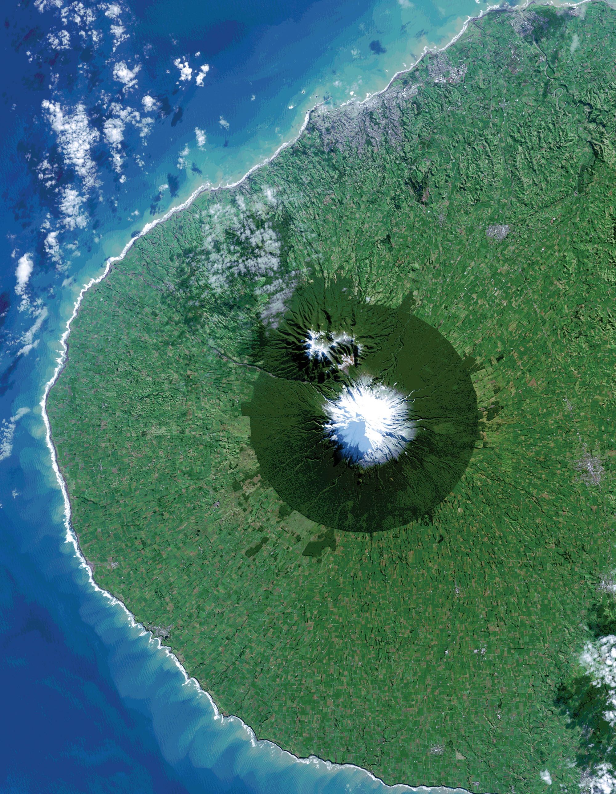
- Institutions that regulate land use access or behavior can have dramatic effects on a landscape as shown in the picture below from New Zealand’s Mount Taranaki. Other institutional arrangements, such as subsidies can dramatically change the land use in entire regions. In Southern Madagascar, patches of forests are sustained in a savannah landscape due to religious institutions as burial sites are exempted from any use (see figure below).
- Cultural aspects on land use include traditions and can be quite resilient to change for good and bad. Cultural change, such as empowerment of women, can change patterns of land use
- Globalization is typically an underlying cause, shifting incentives driven by global demand and values. Developing countries demand for giant shrimp is, for example, an underlying cause for much of the deforestation of mangrove forests in Southeast Asia. But globalization can also reverse some negative impacts, such as the demand for sustainably grown coffee.
Example: Sacred forests in Madagascar
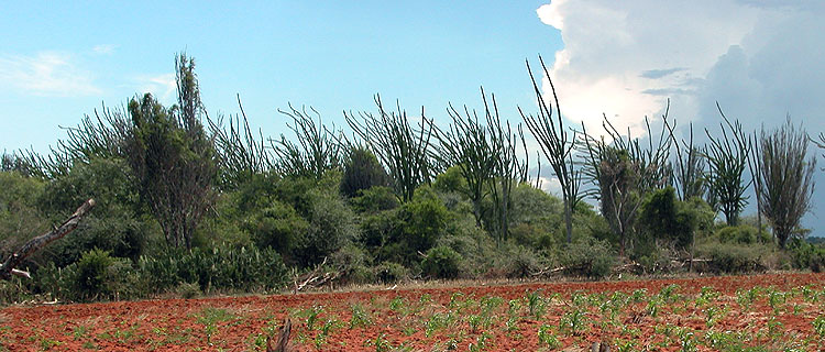
Here is an example of cultural institutions that created a patchy pattern of remnant forest which provide many ecosystem services. Listed as one of the 200 most important regions in the world, the Southern Dry Forest in Madagascar harbors an exceptionally high level of plant endemism or uniqueness. Elmqvist at al. (2010) have expanded previous studies and found that human activities are not necessarily detrimental to the ecosystem dynamics in the areas. On the contrary, social and ecological processes interact, creating situations resulting in forest loss, but also in protection (stable cover) and regeneration.
The Androy region where the Madagascar study was conducted (see map), is situated in the southernmost part of the island. The area is characterized by semi-arid climatic conditions and the dry forest consists of drought-tolerant woody species. In contrast to other types of forests in Madagascar, there are only a few very small areas that are formally under protection, and since the early 1970’s the forest has been reported to be in decline, principally due to clearing for agriculture, cattle herding, timber harvest and charcoal production.
In their study, Elmqvist, Pykkönen and Tengö used Landsat images from southern Madagascar taken in 1984, 1993 and 2000 to detect any changes of the forest cover. Together with interviews with government officials, clan leaders, women and youngsters who did the actual work of exploiting the forests for timber, firewood and grazing, the researchers got a better picture of who had access to forest resources, which rules regulated this access and who actually enforced these rules.
It was found that rather than formal legal definitions of forest protection, it was the informal rules acknowledged and made by forest users that influenced forest conditions.
The most strict and well-reinforced rule was the informal taboo against harvesting in certain portions of the forest areas. Whether or not an area will regenerate may perhaps therefore, in many areas, be less a question of ecological constraints, but rather social variables, the authors conclude.
Zoom in on the map and get a feeling for the scale of forest patches compared to the scale of agricultural fields and human settlements.
Land use change Lecture
Here Johan Rockström will give a deep view on human transformation of planet earth through land use chain, mainly urban and agricultural development.
What land use change can we expect for the future?
Contributors
Jon Norberg, Fredrik Moberg (Madagascar text), Johan Rockström (first video), Eric Lambin (second video)
References
Elmqvist, T., Pykkönen, M, Tengö, M. 2010. Spontaneous Regeneration of Tropical Dry Forest in Madagascar: The Social—Ecological Dimension. In Nagendra, Harini; Southworth, Jane (Eds.), Reforesting Landscapes. Springer Verlag.
Lambin, E., & Geist, H. (2007). Causes of land-use and land-cover change.
Lambin E. F., Turner B. L., Geist H., Agbola S., Angelsen A., et al. 2001. The causes of land-use and land-cover change: moving beyond the myths. Global Environmental Change, 11(4):261-69. Millennium Ecosystem Assessment (MEA). 2005a. Ecosystems and human well-being: synthesis. Island Press, Washington, D.C., USA.
Leave a Comment